The Guardian view on Ordnance Survey maps: still a superior way to navigate the landscape | Editorial
What the source reports
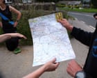
The 225th anniversary of the organisation’s first publication is an opportunity to celebrate its unique contribution to our sense of place In his one-paragraph short story , On Exactitude in Science, Jorge Luis Borges imagines an empire in which the level of cartographical ambition is so high that a map is made on a one-to-one scale with the imperial territory. The quest for perfect accuracy doesn’t end well.
But the earliest map-makers for Ordnance Survey, which this week marked the 225th anniversary of its first publication, might have empathised with the obsessive dedication. The 1801 OS map of Kent was 10 years in the making, its military-led production inspired by fears of Napoleonic invasion. But as Rachel Hewitt points out in Map of a Nation , her stirring account of the Ordnance Survey’s early years, its genesis also lay in an Enlightenment-based enthusiasm for comprehending and accurately representing…
TDBN presents the written preview supplied through the publisher's feed. Complete reporting, continuing updates, context, and corrections remain with the original report.
Read the complete report ↗